
Geography of Nepal
Records mention the Gopalas and Mahishapalas believed to have been the earliest rulers with their capital at Matatirtha, the south-west corner of the Kathmandu Valley. From the 7th or 8th Century B.C. the Kirantis are said to have ruled the valley. Their famous King Yalumber is even mentioned in the epic, ‘Mahabharat’.
- Nepal, country of Asia, lying along the southern slopes of the Himalayan mountain ranges. It is a landlocked country located between India to the east, south, and west and the Tibet Autonomous Region of China to the north.
- In 1923, Britain recognized the absolute independence of Nepal. Between 1846 and 1951, the country was ruled by the Rana family, which always held the office of prime minister. In 1951, however, the king took over all power and proclaimed a constitutional monarchy. Mahendra Bir Bikram Shah became king in 1955.
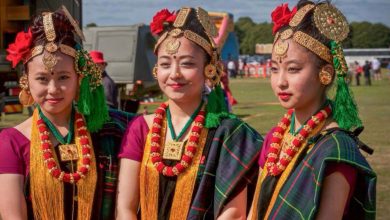
- The history of Nepal has been influenced by its position in the Himalaya and its two neighbours, modern day India and Tibet. It is a multiethnic, multiracial, multicultural, multi religious, and multilingual country.
- Nepal is a sovereign independent kingdom situated on the southern slopes of the mid-Himalayas, the formidable range of eternal shows. It is located between 28.3949° N, 84.1240° E.
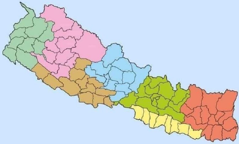
Nepal is a landlocked country located in South Asia with China in the north and India in the south, east, and west. The country occupies 1,47,516 sq. km of land and lies between coordinates approximately 28°N and 84°E. Nepal falls in the temperate zone north of the Tropic of Cancer. The entire distance from east to west is about 800 km while from north to south is only 150 to 250 km. Nepal has vast water systems that drain south into India.
The country can be divided into three main geographical regions: Himalayan region, mid hill region, and the Tarai region. The highest point in the country is Mt. Everest (8,848 m) while the lowest point is in the Tarai plains of Kechana Kalan in Jhapa (60 m).
The government unveils new political map including Kalapani, Lipulekh and Limpiyadhura inside Nepal borders. The new map has added 335 square kilometers of land in Nepal, taking the total area from 147,181 to 147,516.
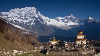
The Mountain Region
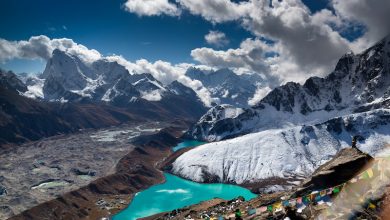
The Mountain Region (called Parbat in Nepali) is situated at 4,000 meters or more above sea level to the north of the Hill Region. The Region constitutes the central portion of the Himalayan range originating in the Pamirs, a high altitude region of Central Asia.
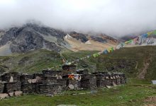
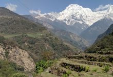


Its natural landscape includes Mount Everest and the other seven of the world’s ten highest peaks, which are the legendary habitat of the mythical creature, the yeti, or abominable snowman. In general, the snow line occurs between 5,000 and 5,500 meters.
The physical features of the nation of Nepal include mountains, wetlands, hills, caves, and plains. The country experiences a wide range of climates, including extreme cold and tropical rain. Nepal features more than 6,000 rivers, many of which are fed from the Himalayan snows or the lowland rains. There are also dozens of caves, some serving as religious pilgrimage sites.
The Hilly Region
Accounting from 64% of the total land of Nepal, the Hill region stands to be the region covering the most land area of the country and inhabits about 43% of the total population of the country. Between the elevation ranges of 610 meters to 4877 meters, the Hill region has some of the most amazing natural landscapes and well as the most diverse culture in Nepal.
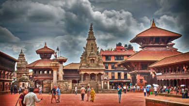
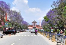
With a great deal of offering the inhabitants as well as visitors, this area has certainly attracted a lot of attention among the varied geography of Nepal. The Hill region is home to many valleys including the Kathmandu valley, and the Pokhara valley is the most popular in the region along with being some of the most populated areas in the geographic area.
The Hill region has an even more extensive diversity with mountains, hills, deep valleys, and flatlands all in a small geographic area. It has a number of beautiful hills, hillocks, valleys, terrace land, small valleys, besi, tars, gorges, and meadows. There are many rivers flowing from the northern part to the southern part of the Terai region.
The Tarai Region
The Tarai region has a width ranging from 26km to 32 km and varies in altitude from 60m to 305 m. It occupies about 17 percent of the total land area of the country. Further north, the Siwalik zone (700 – 1,500 m) and the Mahabharat range (1,500m – 2,700m) give way to the Duns (valleys), such as Trijuga, Sindhuli, Chitwan, Dang and Surkhet. The Midlands (600 – 3,500 m), north of the Mahabharat range is where the two beautiful valleys of Kathmandu and Pokhara lie.